Woodland Islands

- Title: Woodland Islands
- State: Washington
- Project type: USACE
- Greater Beneficial Use Area: Lower Columbia River estuary
- Focus Area approximate center coordinates: 45.8800, -122.800
- Nearest Federal Navigation Project: Lower Columbia River Federal Navigation Channel
- Owner: USACE Portland District
- Beneficial Use Categories: Aquatic Habitats, Island Habitats, Upland Habitats
- Dredge type: Hydraulic
- Status: Completed
- Keywords: island restoration, salmon habitat, yellow warbler
Description:
The Lower Columbia River (LCR) stretches across Washington and Oregon, ultimately flowing into the Pacific Ocean. USACE Portland District (NWP) maintains a federal navigation channel, spanning 110 miles in length and reaching a depth of 43 feet. This crucial deep draft channel serves as a vital artery for transporting over 40 million tons of cargo annually, with a total value of $23 billion. To ensure its accessibility and functionality, the channel requires annual dredging, removing approximately 6 to 8 million cubic yards of sediment.
Over the past century, the construction of dams and dikes has altered the natural flow patterns within the LCR. Consequently, an alarming 75% of its tidal habitat has disappeared, primarily due to decreased sediment deposition. This habitat loss has had a detrimental impact on fish populations that rely on shallow water estuarine habitats for essential activities such as feeding and resting. Among the affected species are threatened and endangered salmonids.
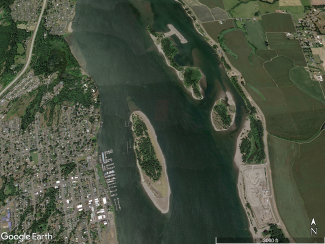
Woodland Islands, situated along the Washington side of the LCR between river miles 86 and 84.5, comprises a chain of four small islands and a side channel. In the late 1800s, NWP initially created these islands by placing sediment dredged from the nearby St. Helens Bar around timber pile dikes constructed to stabilize the LCR navigation channel. However, after sediment placement ceased in the 1970s, the land mass that once formed a peninsula eroded, resulting in the formation of the current island chain.
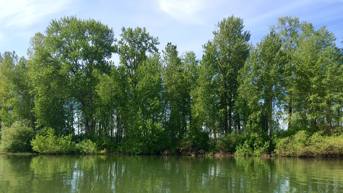
In response to this ecological challenge, in 2017, NWP and the Columbia River Estuary Study Taskforce (CREST) partnered with the Bonneville Power Administration, National Marine Fisheries Service, US Fish and Wildlife Service, and the Expert Regional Technical Group to restore Woodland Islands using and promote the recovery of fish and wildlife populations in the river. The Woodland Islands project aimed not only to restore low-velocity shallow water/wetland habitats for juvenile salmonids but also to create topographic diversity, including submerged, emergent, and upland areas, to support a wide range of bird species such as the yellow warbler, as well as native mammals, reptiles, amphibians, and non-listed aquatic species.
After three years of planning, Phase I of the project was successfully completed in the fall of 2020. During this phase, 225,000 cubic yards of sediment from routine dredging of St. Helens Bar were hydraulically pumped, placed, and graded at the site. As a result, approximately seven acres of new land was created in the side channel, creating a peninsula alongside one of the existing islands. Compost was added to upland areas to enhance soil composition, and native riparian and upland grasses, shrubs, and saplings were planted through early 2023.
NWP is actively monitoring and adaptively managing the site until 2028 to ensure the successful restoration of the habitat, which will enhance populations of not only salmonids but also other native fish and wildlife in the LCR. The ongoing monitoring efforts encompass fish surveys, bathymetric measurements, benthic macroinvertebrate assessments, and vegetation surveys.
The Woodland Islands project serves as an exemplary demonstration of stakeholders collaborating to beneficially use sediment from routine dredging maintenance of a navigation channel for the restoration of nearby critical habitats. Overall, the partnership between NWP, CREST, and the various stakeholders, underscores a collective commitment to restoring and preserving the ecological integrity of the LCR. This approach yields positive and far-reaching effects, providing a blueprint for future projects aiming to balance navigation needs and ecological restoration.
Gallery:

Further readings:
- Bonneville Power Administration. (2020). Supplemental Analysis for the Columbia Estuary Ecosystem Restoration Program EA: Woodland Islands Habitat Restoration Project. United States Department of Energy, Bonneville Power Administration. June 17.
- Gailani JZ, Suedel BC, McQueen AD, Lauth TJ, Scheiblechner U, Toegel R. (2022). Supporting Bank and Near-Bank Stabilization and Habitat Using Dredged Sediment: Documenting Best Practices. ERDC TR-22-10. USACE, Engineer Research and Development Center. August.
- USACE Portland District. (2020). Woodland Islands, Lower Columbia River Estuary. Section 204 Studies: Beneficial Use of Dredged Material for Ecosystem Restoration. Integrated Feasibility Study & Final Environmental Assessment. March.
- USACE Portland District. (2020). Supplemental Assessment Addressing: Climate Preparedness and Resilience, Woodland Islands, Lower Columbia River Estuary. Appendix B: Hydrology and Hydraulics Analysis, Integrated Feasibility Study & Final Environmental Assessment. United States Army Corps of Engineers, Portland District. March.
Presentations:
- Moritz H, Fraver M, Negherbon L, Turaski M, Wells K, Ringold V, Landre L, Gornick J, Norton J, Stokke J, et al. (2018). Habitat Restoration Using Dredged Material Placement Within the Lower Columbia River at Woodland Islands, WA. USACE Portland District.
- Moritz H, Bierman M, Stokke J, Royer I, Trachtenbarg D, Woolbright R, Littles C, Stolt R, Norton J, Holm J, Josephson T, Hruska T. (2022). Using Dredged Material to Restore Salmonid Habitat within the Lower Columbia River. Presented at American Fisheries Society Annual Meeting: River Rehabilitation in the Anthropocene: Changing Face of Fisheries Management. USACE Portland District. August 25.
- Moritz HR, Fraver, M., Turaski, M., Well, K., Ringold, V., Landre, L., Gornick, J., Norton, J., Stokke, J. (2018). Habitat Restoration, Using Dredged Material Placement Within the Lower Columbia River (LCR) at Woodland Islands, WA. Presented at Western Dredging Associations- Pacific Chapter, Fall 2018 Conference. October 23-25.
- Moritz HR, Bierman M, Stokke J, Royer I, Trachtenbarg D, Littles C, Stolt R, Norton J, Hruska T, Josephson T. (2022). Accommodating Climate Change When Restoring Salmonid and Avian Habitats within the Lower Columbia River, Oregon and Washington. United States Army Corps of Engineers, Portland District and Columbia River Estuary Study Taskforce. September.
Website links:
- CREST. (2024). Background: Why Protect and Restore the Columbia River Estuary.
- Lower Columbia Estuary Partnership. (2024). Columbia River Estuary Ecosystem Classification.
- USACE. (2024). Portland District: Navigation.
- USACE. (2024). Portland District: Lower Columbia River.
News releases:
- The Columbian. (2018). Columbia River Shipping Channel Requires a Lot of Upkeep, While Dredged Material Gains Value. September 9.
- USACE Portland District. (2022). Corps, Sponsor Ports Host Open Houses on 20-Year Dredged Material Placement Plan. April 18.

