
Montezuma Wetlands Restoration
- Title: Montezuma Wetlands Restoration
- State: California
- Project type: Private
- Greater Beneficial Use Area: San Francisco Bay
- Focus Area approximate center coordinates: 38.0994, -121.8866
- Nearest Federal Navigation Project: San Pablo Bay and Mare Island Strait
- Owner: Montezuma Wetlands, LLC
- Beneficial Use Categories: Wetland Habitats, Aquatic Habitats
- Dredge type: Hydraulic
- Status: Ongoing
- Keywords: marsh creation, hydrologic connectivity, wetland restoration, bird habitat, fish habitat
Description:
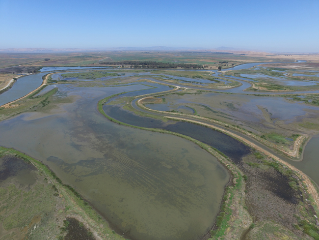
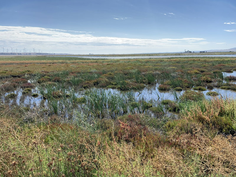
Historically, tidal wetlands in San Francisco Bay, California, played a vital role in providing essential ecosystem services. They offered flood protection, improved water quality, and served as essential habitats for wildlife. However, due primarily to human activities like dike construction and agricultural practices, these key benefits were degraded or lost in many wetland areas over time. One such impacted area on the eastern side of the Suisun Marsh is where the 2,400-acre historical Montezuma wetlands are located, where the Montezuma Wetlands Restoration (MWR) project was initiated.
Montezuma Wetlands LLC, leading the project in partnership with the US Army Corps of Engineers San Francisco District, the Port of Oakland, and the San Francisco Estuary Institute, leverages their partnerships to beneficially use sediments dredged from regional waterways to help restore the ecosystem functions through the restoration of marsh habitats. The MWR project is one of the only habitat restoration projects in the Bay Area that can accept and use moderately contaminated sediments, which are contained and isolated from biological receptors by clean cover sediment.
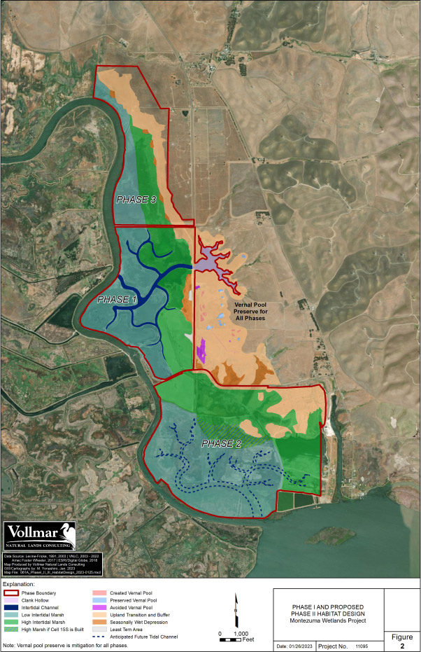
The three-phase MWR project, initiated in 1990 and permitted in 2001, aims to restore approximately 1,800 acres of tidal and seasonal wetlands, intertidal ponds, seasonal pools, and upland buffer zones. By prioritizing habitat restoration, the project seeks to enhance resilience to sea level rise while also supporting wildlife, including endangered species. Phase 1 is expected to be completed in 2024 with approximately 9 million cubic yards of sediment placed. Phase 2 began in 2019 and is anticipated to take 15 years to place 15-20 million cubic yards of sediment. The final phase, Phase 3 has a timeline that is dependent on the completion of Phase 2 and sediment delivery and anticipates the placement of 5-8 million cubic yards of additional sediment. This project notably demonstrates the beneficial use of dredged sediment, with plans to use approximately 29-37 million cubic yards in total to help restore the Montezuma wetlands.
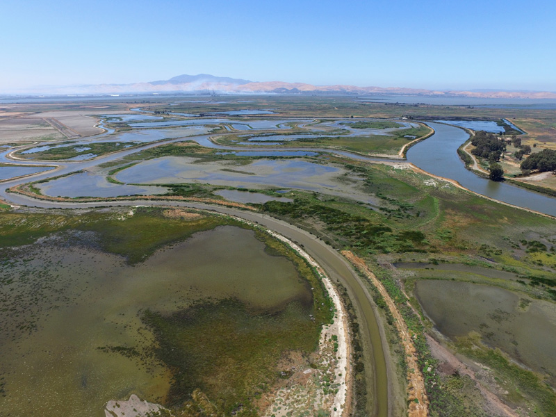
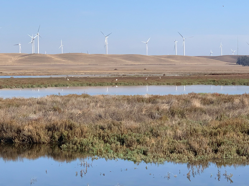
Phase 1 of the project (630 acres) was funded by Montezuma Wetlands LLC and supplemented by funding from the San Francisco Bay Restoration Authority. During this phase, infrastructure, including pipelines, levees, and offloading facilities, was constructed to efficiently manage dredged sediment. The design of sediment-holding cells allowed for their transformation into tidal channels once the site was reconnected to the estuary. This construction phase was completed in October 2020, enabling tidal flow and natural sedimentation to support marsh vegetation. Initial monitoring results indicate an increase in wildlife, including shorebirds, waterfowl, and native fish species. The project will continue to monitor species abundance and occurrence, water quality, and tidal channel formation throughout the remaining construction phases as well as for up to ten years following the completion of all construction phases.
The success of the MWR project demonstrates the role dredged sediments play in nature-based restoration solutions. The innovative design of sediment-holding cells enabled the site to reconnect with the estuary tidal flow to allow for more natural sedimentation which in turn helps to support marsh vegetation and wildlife. Phase 2, encompassing approximately 1,100 acres, unfolded in 2019 and the MWR project continues to serve as a model of private-public partnership in Northern California.
Gallery:
Gallery:
Further readings:
- Acta Environmental, Inc. (2018). Report on Biological Surveys, 2015-2017, Montezuma Wetlands Project, Solano County, California. Prepared for Montezuma Wetlands LLC. April 20.
- California Regional Water Quality Control Board. (2012). Tentative Order: Updated Waste Discharge Requirements, Water Quality Certification, and Rescission of Order No. 00-061 for: Montezuma Wetlands LLC, Montezuma Wetlands Restoration Project, Solano County. November 14.
- Levine J. (2020). Montezuma Wetlands Project: A Private Initiative to Solve Two Regional Problems. Montezuma Wetlands LLC. December 4.
- Montezuma Wetlands LLC. (2008). Montezuma Wetlands Project Technical Review Team (TRT) Charter. June.
- San Francisco Bay Conservation and Development Commission, San Francisco Bay Regional Water Quality Control Board, USACE, U.S. Environmental Protection Agency. (2012). Beneficial Reuse Meeting Materials Package. June.
- San Francisco Bay Restoration Authority. (2018). Staff Recommendation: Montezuma Wetlands Restoration Project, Phase 1. April 11.
- San Francisco Bay Restoration Authority. (2023). Staff Recommendation: Montezuma Wetlands Restoration Project, Phase 2. March 3.
- USACE San Francisco District. (2001). Department of the Army Permit. Permittee: Montezuma Wetlands LLC. September 24.
Website links:
- California EcoAtlas. (2023). “Montezuma Wetlands Restoration Project.”
- Montezuma Wetlands LLC. (2023). “Welcome to the Montezuma Wetlands.”
- San Francisco Estuary Institute & The Aquatic Science Center. (2023). “Montezuma Technical Review Team.”
Videos:
Montezuma Wetland Restoration Project Presentation 1. YouTube, Uploaded by Restoration Authority, 16 Dec 2021.
News releases:
- Camhi T. (2018). How Dredging the Bay Is Helping Restore Delta Wetlands. KQED. August 15.