Hamilton Wetland Restoration Project

- Title: Hamilton Wetland Restoration Project
- State: California
- Project type: USACE
- Greater Beneficial Use Area: San Francisco Bay, Pacific Ocean
- Focus Area approximate center coordinates: 38.0600, -122.5090
- Nearest Federal Navigation Project: San Pablo Bay and Mare Island Strait
- Owner: USACE San Francisco District
- Beneficial Use Categories: Aquatic Habitats, Wetland Habitats
- Dredge type: Hydraulic
- Status: Complete
- Keywords: wetland restoration, tidal marsh, bird habitat, fish habitat, dredged sediment, San Francisco Bay
Description:
Between 1800 and the late 1990s, approximately 80% of tidal marshes in San Francisco Bay, California was eliminated due to the construction of dikes, filling land, mining, farming, and urban development. Tidal wetlands provide critical ecosystem services such as flood protection, water quality improvement, fish and bird habitat, and recreation. In the past two decades, state and federal agencies have coordinated efforts on multiple remediation projects to reach a goal of doubling the amount of tidal marsh habitat in San Francisco Bay. One such effort is the Hamilton Wetland Restoration Project (HWRP).
The HWRP site, spanning nearly 2,600 acres along San Pablo Bay in Novato, California, experienced subsidence due to historical draining practices involving levees, ditches, and pumps, resulting in an average elevation five feet below sea level. Initially drained for agriculture, in the 1920s the area was developed and became the Hamilton Air Force Base. Following the base’s closure in 1994, the California State Coastal Conservancy (SCC) partnered with the US Army Corps of Engineers South Pacific Division-San Francisco District (SPN) and San Francisco Bay Conservation and Development Commission (BCDC) on the HWRP initiatives. Congress authorized SPN to fund 75% of the project under the Water Resources Development Act. The first phase of the HWRP focused on converting the airfield of the former Hamilton Air Force Base by beneficially using dredged sediment to counteract the subsidence, create tidal and seasonal marsh habitat, and reestablish hydraulic connectivity with the bay.
Beginning in 2007, SPN strategically placed approximately 5.8 million cubic yards of dredged sediment, primarily from the nearby Port of Oakland harbor deepening project, onto the former airfield. The sediment, pumped through pipelines and placed hydraulically, was subsequently graded, and shaped to restore the land’s natural elevation, promote tidal channel formation, and accelerate wetland vegetation growth. After completing the sediment placement, a 2.7-mile portion of the San Francisco Bay Trail was constructed along the site’s perimeter to promote recreational access. In 2014, the bay-facing levee was breached, opening the site to tidal action for the first time in over a century and resulting in the establishment of approximately 660 acres of tidal, brackish, and freshwater wetlands.
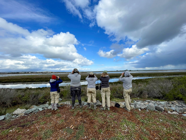
Like many restoration projects, HWRP has battled the encroachment of invasive species, which threatens native vegetation and the balance of newly restored ecosystems. Therefore, after reestablishing tidal connections, the project team planted native vegetation and committed to ongoing site monitoring and management through 2026. Recent monitoring indicates the site has become a sanctuary for a diverse range of bird species, including raptors, shorebirds, and waterfowl, all utilizing the new wetlands for foraging and nesting. The restoration also benefits fish at various life stages by offering essential breeding and nursery habitats. Additionally, aquatic invertebrates, vital to wetland food webs, are thriving in the revitalized ecosystem.
The success of this portion of the HWRP project has led the SCC and SPN to extend similar remediation efforts to the adjacent 1,600-acre Bel Marin Keys parcel, contributing to concurrent efforts around San Francisco Bay that have restored around 30,000 acres of tidal wetlands. The success of HWRP demonstrates the beneficial use of dredged sediment on a large scale and how coordinating efforts in a region can support navigation in coastal bays while also improving critical ecosystems.
Further readings:
- California State Coastal Conservancy (SCC). (2021). Hamilton Wetlands Restoration Project Implementation. March 25.
- Schuchat S. (2017). Hamilton/Bel Marin Keys Wetlands Restoration. California State Coastal Conservancy. June.
- U.S. Army Corps of Engineers (USACE). (2012). Review Plan: Hamilton Wetland Restoration Project, Marin County, CAn. United States Army Corps of Engineers, San Francisco District. August 21.
- U.S. Environmental Protection Agency and USACE. (2007). Beneficial Uses of Dredged Materials Case Study: San Francisco Bay Regionn. Report No.: EPA842-F-07–001A. October.
Website links:
- California EcoAtlas. (2023). Hamilton Wetlands Restoration.
- SCC. (2023). Hamilton Wetlands Restored!
- USACE San Francisco District. (2023). Hamilton Airfield Wetland Restoration.
Videos:
Panel 1: The Future of the LTMS and DMMO. YouTube, Uploaded by Bay Planning Coalition, 22 November 2013.
Panel #2: Wetlands Restoration and Beneficial Reuse. YouTube, Uploaded by Bay Planning Coalition, 25 November 2013.
News releases:
- Fimrite P. (2014). Marin County Wetlands Rise Again in Hamilton Airfield Restoration. SFGate. April 26.
- Kunz D. (2021). Designed and Delivered: Hamilton Wetlands Restoration Project. Environmental Science Associates. November 29.

