
DULUTH HARBOR
- Title: Duluth Harbor
- State: Minnesota
- Project type: USACE
- Greater Beneficial Use Area: Great Lakes, Lake Superior
- Focus Area approximate center coordinates: 46.7620, -92.1200
- Nearest Federal Navigation Project: Duluth-Superior Harbor
- Owner: USACE Detroit District
- Project Partners: City of Duluth, Minnesota Department of Natural Resources, Minnesota Pollution Control Agency, and US Environmental Protection Agency
- Beneficial Use Categories: Aquatic Habitats
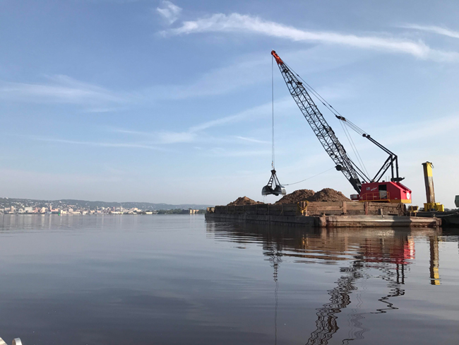
- Dredge type: Mechanical
- Status: Completed in 2018
- Keywords: Duluth-Superior Harbor, 21st Avenue West, St. Louis River estuary, dredging, shoreline habitat, benthic habitat, wetlands, fish and wildlife habitat
Description:
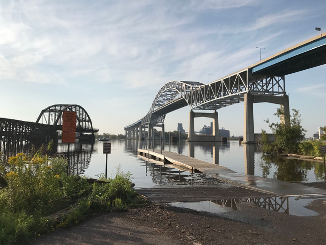
The Duluth-Superior Harbor is a deep draft commercial harbor located at the westernmost point of Lake Superior on the Minnesota-Wisconsin border, with Duluth, Minnesota, to the north and Superior, Wisconsin, to the south. It is the largest port in the Great Lakes and the westernmost port in the US with direct access to the Atlantic Ocean. The USACE Detroit District (LRE) is responsible for maintaining the harbor and its associated 18 miles of federal navigation channels. The USACE is authorized to maintain channel depths ranging from 20 to 32 feet and requires dredging of approximately 110,000 cubic yards of shoaled sediment annually. The US economy could potentially face an estimated increase of up to $30 million in annual transportation costs if channel depth is not maintained. This, in turn, may compel ships to reduce their cargo loads and result in heightened carbon emissions due to additional transits. The majority of sediments dredged from the Duluth-Superior Harbor navigation channels require no special handling and are chemically suitable for beneficial uses, including restoration of aquatic habitats. The USACE’s authority and ability to manage sediments dredged from federal navigation channels are important tools in the USACE’s ecosystem restoration toolbox.
The Duluth-Superior Harbor is situated in the 12,000-acre St. Louis River freshwater estuary, which is the largest tributary to Lake Superior. The early industrial activity contaminated the estuary’s sediment, leading to the degradation of its habitat quality. In 1989, a large area, including the estuary and harbor, was designated as the St. Louis River Area of Concern (AOC), with multiple Beneficial Use Impairments (BUIs) identified. The St. Louis River Remedial Action Plan outlined the BUIs and ways to address them. In the early 2010s, LRE began developing a program to place dredged sediment from navigation channels in the estuary to aid in removing two of the BUIs: degradation of benthos (i.e., bottom-dwelling flora and fauna) and loss of fish and wildlife habitat.
As part of a broader initiative to place dredged sediment at various sites in the St. Louis River estuary, LRE partnered with the US Environmental Protection Agency (USEPA), Minnesota Pollution Control Agency (MPCA), Minnesota Department of Natural Resources (MDNR), and City of Duluth to conduct a pilot study to test a new approach for using dredged sediment to improve benthic conditions. The 21st Avenue West embayment, a 350-acre complex consisting of open water flats and shallow sheltered bays on the Duluth shoreline, was selected for the pilot study. The LRE study design focused on areas with a high probability of improved conditions, and analyzed the current circulation patterns at the site to optimally place sediment to harness natural transport processes for the creation of diverse shoreline habitat. A shallow water placement/estuary hydraulic model was developed to optimize the dredging and sediment placement process.
The pilot study was conducted from 2013 to 2015, leading to full-scale construction at the site from 2016 to 2018. Over 783,000 cubic yards of dredged sediment from the nearby navigation channel were placed in the project area to complete the approved designs, which included the creation of shoals and islands, as well as the burial (in situ capping) of contaminated sediment within the embayment footprint. Two years after construction was completed, samples collected in the 21st Avenue West project area indicated a 10% improvement in macroinvertebrate community index scores. Additionally, the new shallow-water hydraulic model was validated.
Overall, the project was deemed a success. LRE has adapted and applied the processes used at the 21st Avenue West site to successfully place dredged sediment in other habitat restoration areas within the AOC, such as the nearby 40th Avenue West site. The improved benthic habitat will help the fish population and birding opportunities and contribute to the restoration of wetland habitats, all of which are goals for the St. Louis River AOC and the Great Lakes in general. These benefits will lead to increased opportunities for recreational fishing and direct support of local economies. Building on the success of their new approach, LRE has multiple active remediation and habitat restoration projects planned or ongoing in the AOC that use dredged sediment from the navigation channel to support various environmental remediation, beach nourishment, and habitat restoration projects.
Further readings:
- Bridges TS, Bourne EM, King JK, Kuzmitski HK, Moynihan EB, and Suedel BC. (2018). Engineering With Nature: An Atlas. ERDC/EL SR-18-8. Vicksburg, MS: USACE, Engineer Research and Development Center.
- Hayhurst B, Buscaglia K, Breneman D, and Keil K. (2023). 21st Avenue West: A Pilot Study for Beneficial Use of Dredged Material for Addressing Degraded Aquatic Habitat and Benthic Communities. Engineering With Nature, Story Map.
- Minnesota Pollution Control Agency. (2015). St. Louis River Area of Concern Quality Assurance Program Plan for Minnesota Based Projects. January.
- Groten JT, Ellison CA, and Mahoney MH. (2016). Three-dimensional visualization maps of suspended-sediment concentrations during placement of dredged material in 21st Avenue West Channel Embayment, Duluth-Superior Harbor, Duluth, Minnesota, 2015. U.S. Geological Survey Scientific Investigations Report 2016–5086, 26 p.
- USACE. (2015). 21st Avenue West Restoration, Duluth, Minnesota, Design Documentation Report. December.
Presentations:
- Breneman D. (2019). Beneficial Use Opportunities- Lessons Learned in Duluth/Superior. June 11.
Website links:
Videos:
Duluth Canal Cam. YouTube, Uploaded by Duluth Harbor Cam, Started streaming on 4 May 2021.